
ZL190 Handheld GPS for Surveying, High Precision GPS Surveying Equipment for Mountainous Land Slope and Flat Field Outdoor Use
Original price was: €139.99.€103.99Current price is: €103.99.
14 in stock
**Product Title:** ZL190 Handheld GPS for Surveying – High Precision GPS Surveying Equipment for Mountainous Land, Slope, and Flat Field Outdoor Use
**Product Description:**
Elevate your surveying projects with the ZL190 Handheld GPS for Surveying, the ultimate high-precision tool designed for both professional and recreational use. Whether you’re navigating the rugged terrains of mountainous landscapes or mapping out flat fields, this state-of-the-art GPS equipment provides unparalleled accuracy and reliability.
**Key Features:**
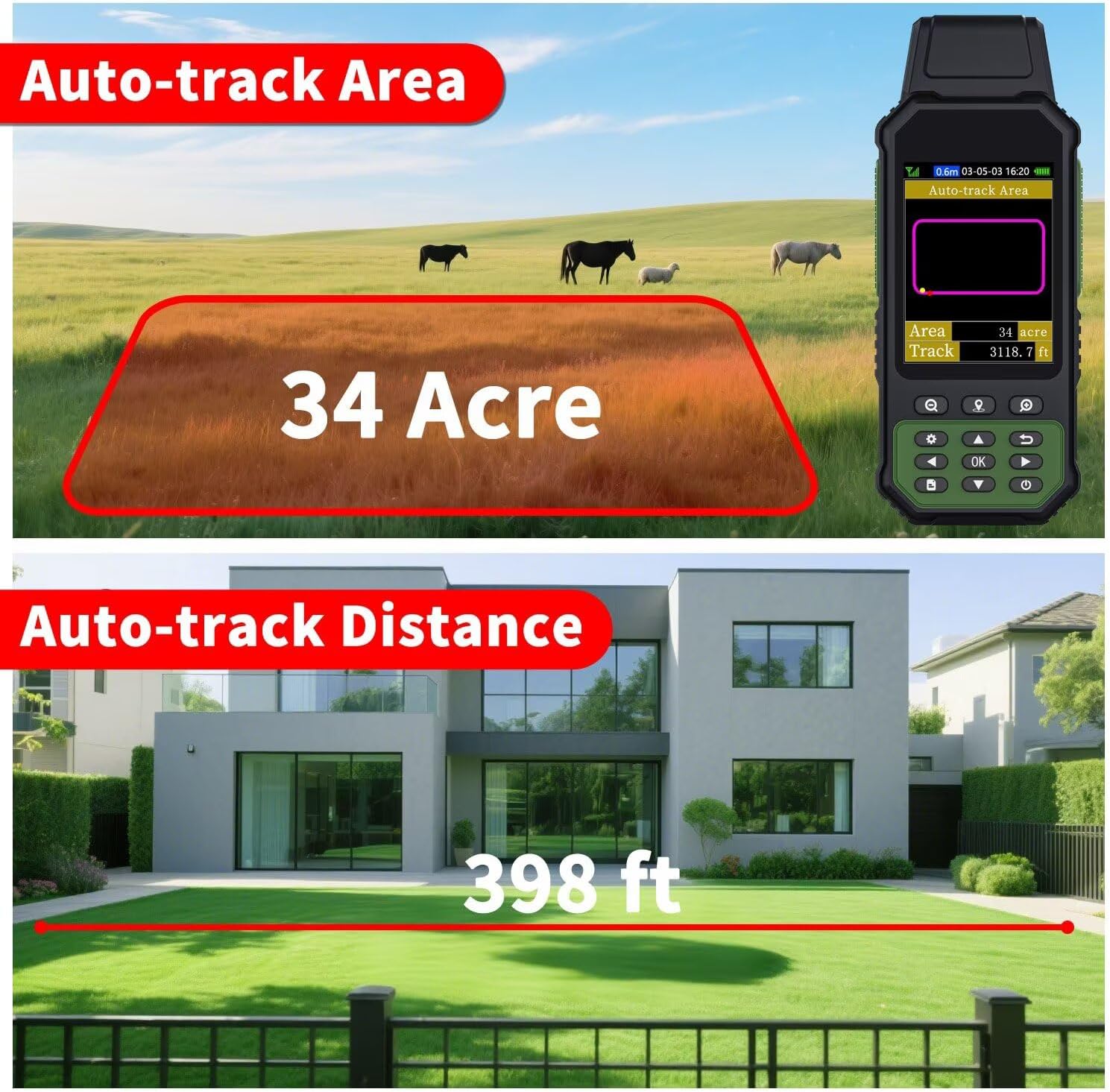
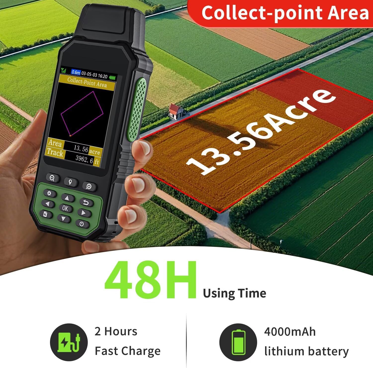
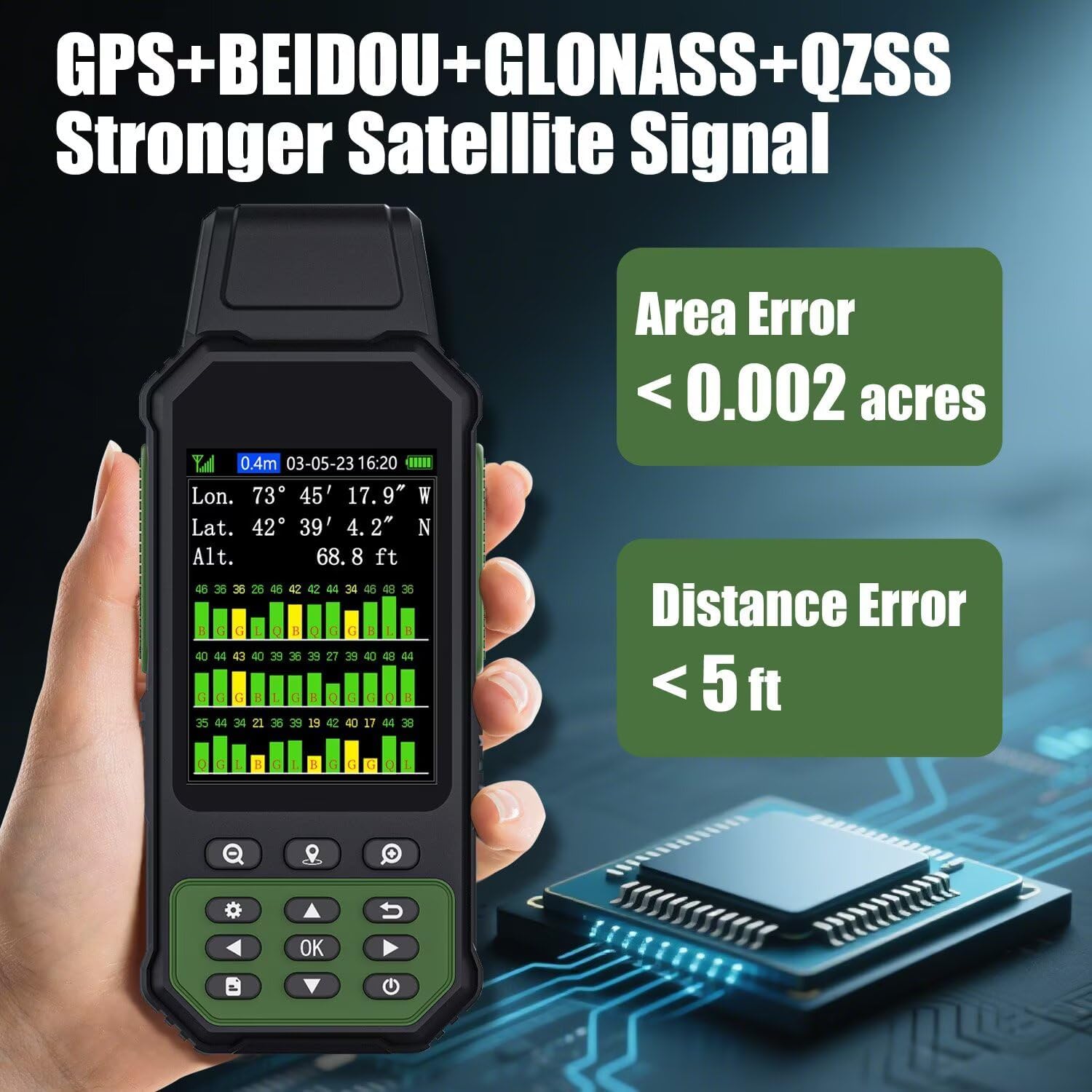
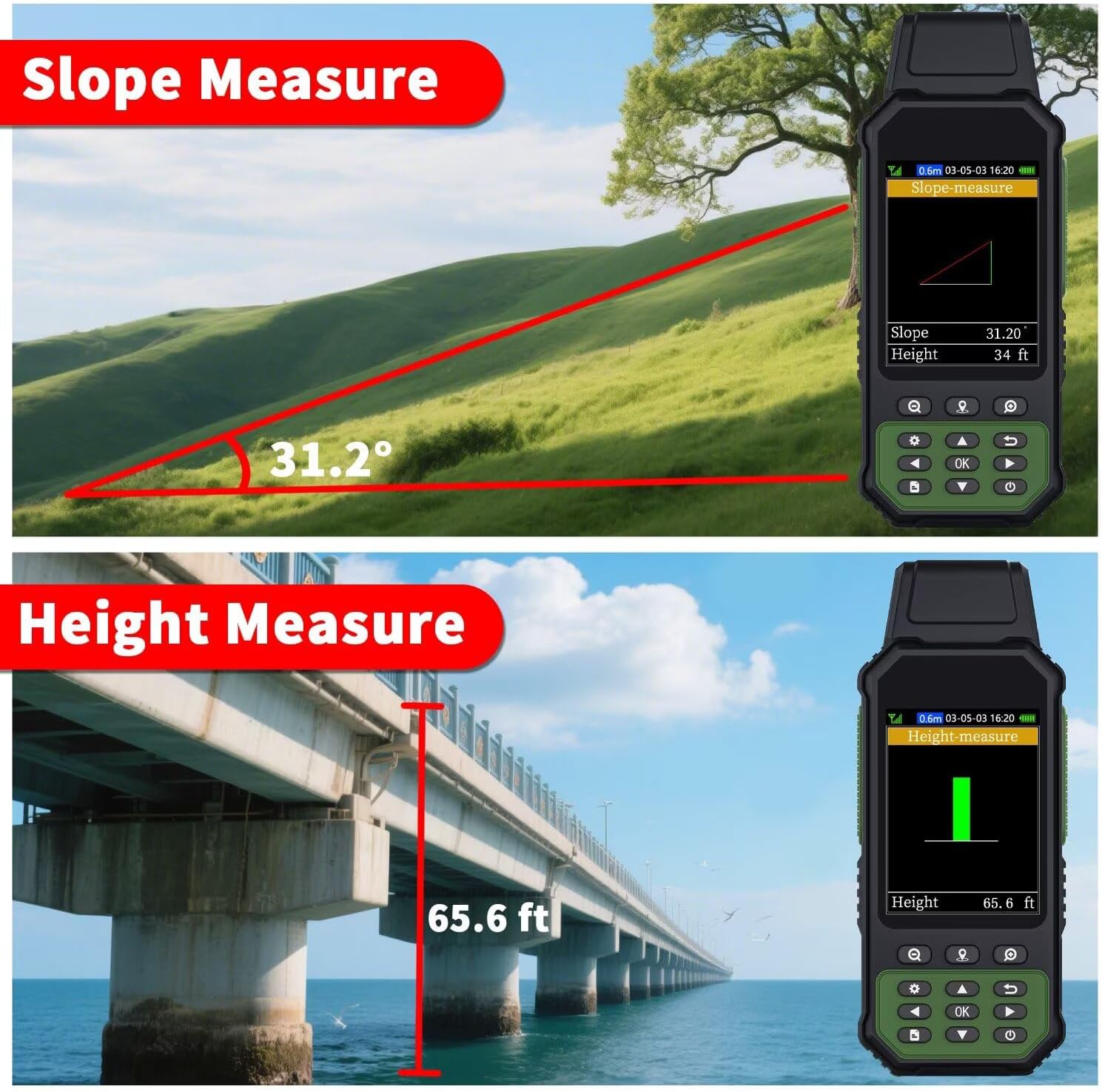
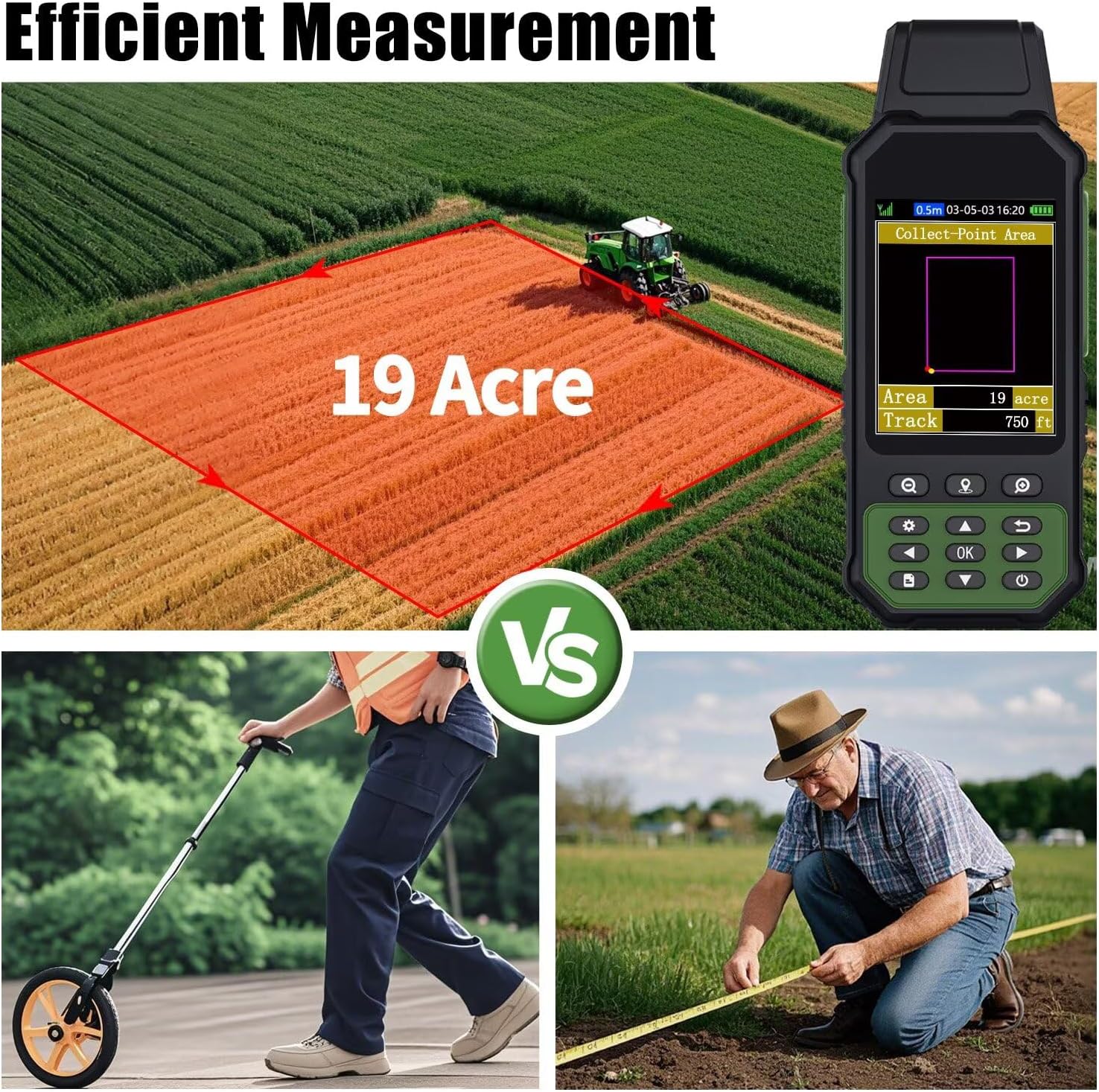
– **High Precision Accuracy:** Engineered with advanced satellite technology, the ZL190 delivers pinpoint accuracy, ensuring precise measurements in even the most challenging environments.
– **Versatile Applications:** Perfectly suited for a wide range of surveying tasks, from mountainous land and slopes to flat fields, making it an indispensable tool for surveyors, geologists, and outdoor enthusiasts alike.
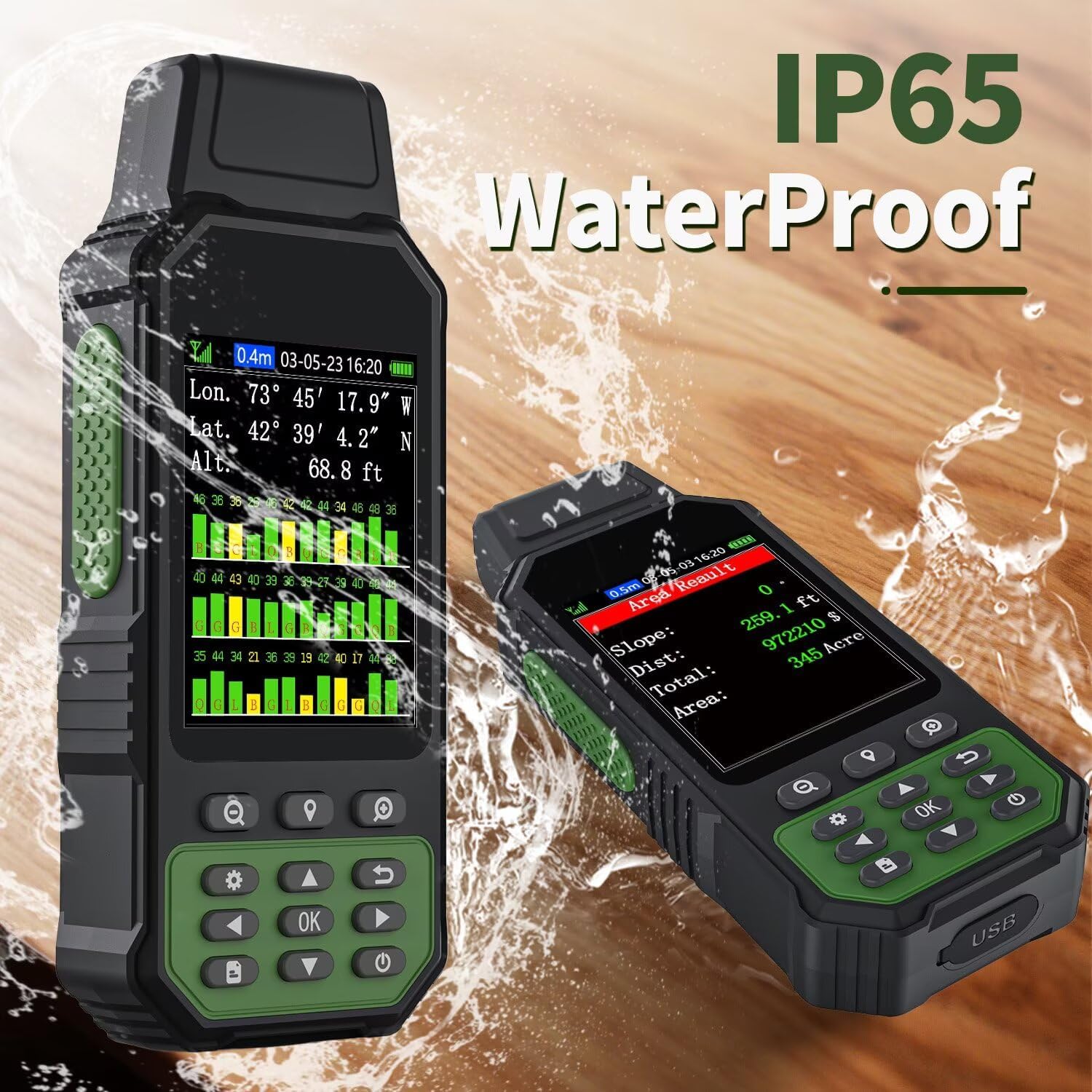
– **Robust and Durable Design:** Built to withstand the elements, the ZL190 is both water-resistant and shockproof, providing durability and performance in any outdoor setting.
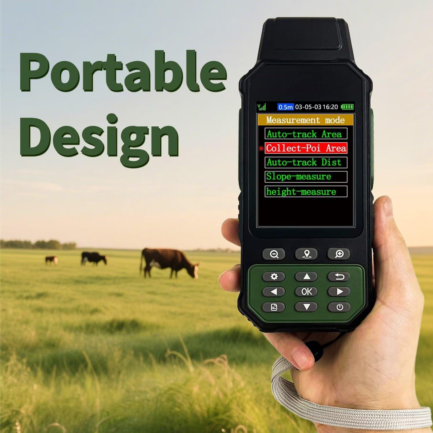
– **User-Friendly Interface:** Featuring a large, easy-to-read display and intuitive controls, this GPS device ensures a seamless user experience for both beginners and seasoned professionals.
– **Long Battery Life:** Equipped with a long-lasting battery, the ZL190 ensures uninterrupted operation throughout your surveying projects.
– **Portable and Lightweight:** Its compact design allows for easy transportation and handling, making it the ideal companion for on-the-go surveying tasks.
**Technical Specifications:**
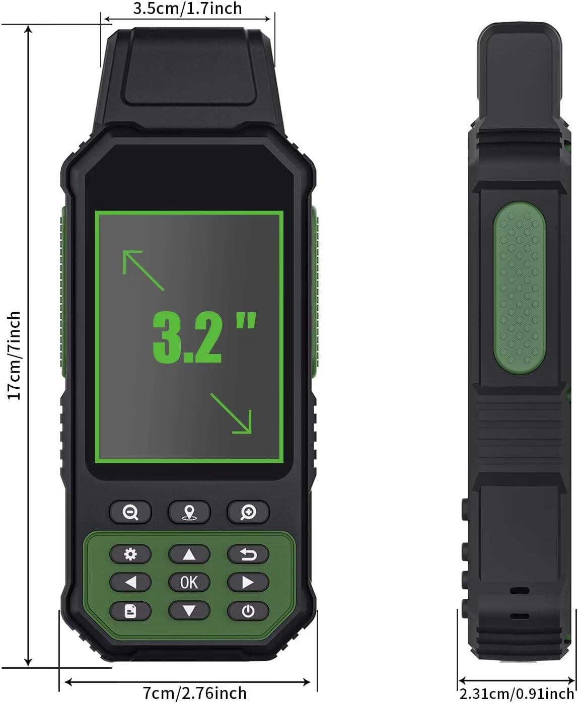
– **Display:** High-resolution LCD
– **Connectivity:** Bluetooth and USB
– **Battery Life:** Up to 15 hours of continuous use
– **Water Resistance:** IP67 certified
– **Weight:** 0.5 kg
**Package Includes:**
– ZL190 Handheld GPS Device
– Protective Carrying Case
– USB Charging Cable
– Quick Start Guide
– Warranty Card
**Why Choose the ZL190?**
With the ZL190 Handheld GPS for Surveying, you’re investing in precision, reliability, and ease of use. It’s more than just a GPS device; it’s a comprehensive solution for accurate land assessment and mapping, tailored to meet the demands of challenging terrains.
Unlock the potential of your surveying projects with the ZL190 – where accuracy meets innovation.
**Customer Reviews:**
⭐⭐⭐⭐⭐ “The ZL190 has transformed how we conduct our field surveys. Its precision is unmatched!” – Surveying Professional
⭐⭐⭐⭐ “A must-have for any serious surveyor. Durable, accurate, and user-friendly.” – Geologist
Embark on your next surveying adventure with confidence, knowing the ZL190 Handheld GPS for Surveying has got you covered.
Related products
-
Sale!

Wireless Earbuds, ENC Noise Cancelling Sport Ear Buds with Multifunctional Touch Screen, Bluetooth 5.4 Headphones, Bass Stereo Sound, 5 EQ Over The Ear Earbuds for Sports/Workout/Gym-Black
Original price was: €199.99.€25.99Current price is: €25.99. -
